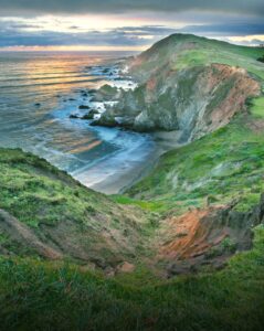
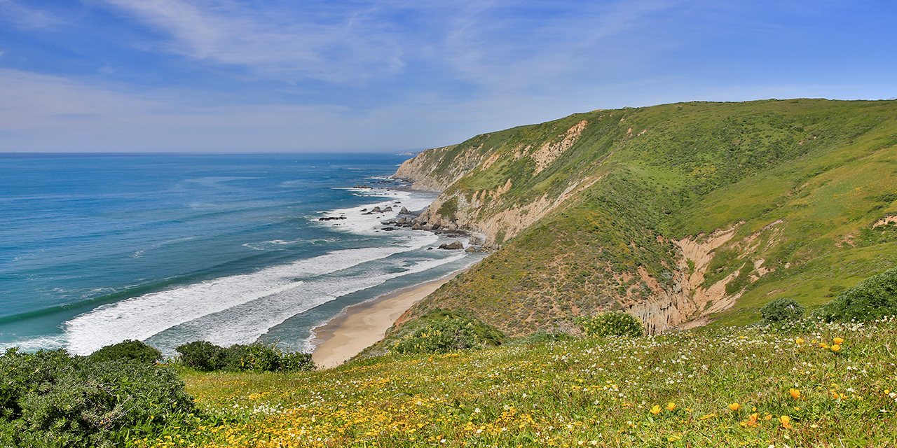
“The dramatic coastline and seashore of Northern California’s Pacific Coast”
Rolling hills, mighty redwoods, sandy beaches and bluffs high above the Pacific, create an exciting seascape along Route 1, the Pacific Coast Highway north of San Francisco. This infamous coastal road follows the Pacific coastline through Washington, Oregon and California. Crossing the Golden Gate Bridge Route 1 becomes a two-lane road winding through the hillsides of forest and redwoods, with very few towns along the way.
Having already traveled the Oregon Coast and the central/southern portion of the Pacific Coast Highway, we are anxious to experience this “lesser know” and “lesser traveled” coast. Once the road returns to the shoreline we stop for a quick view of the Pacific Ocean at Stinson Beach.

Just past Stinson Beach, the drive is along Bolinas Lagoon, a shallow area of water enclosed by a sandpit noted for it’s abundance of bird and marine life. Searching carefully we locate the road to Bolinas, a funky small town hidden off the main road. In the 60’s hippies found this out-of-the-way deserted town and settled there. Bolinas continues to maintain the unique culture of its hippie beginnings with artsy shops, organic stores and a feel of going back in time. Needing a good lunch before heading to Point Reyes National Seashore, we select the Coast Café. The Café offers local home cooked food. The hearty soup and salad are perfect. We take a few minutes to pop into a few of the shops and appreciate the work of the local artists and craftsmen.

The highway turns inland as the Point Reyes National Seashore protects the 71,000 acres of this triangular peninsula. Known as the foggiest and windiest on the entire Pacific Coast, Point Reyes offers the thrill of thundering ocean breakers crashing against rocky headlands, expansive sand beaches, grasslands, rolling hillsides and forested ridges. Visitors can discover over 1000 species of plants and animals.
Checking in at the Bear Valley Visitor Center, we peruse the exhibits explaining the history of the Point Reyes National Seashore and the Point Reyes Peninsula which rides on the eastern edge of the Pacific plate. Just outside the visitor center in Olema, the North American and Pacific plates grind together along the San Andrea Fault Zone. The pressure from these plates can build up causing an earthquake. In 1906 with the San Francisco Earthquake, the Peninsula leaped 20 feet northwestward.

The Ranger recommends we drive to the Point Reyes Lighthouse and also to Chimney Rock for some great views of the Pacific Ocean. It is a beautiful day, with clear skies. Usually in June the Point Reyes Lighthouse is shrouded in fog and often even closed due to high winds. We follow the 21 mile slow twisting road atop the ridge to the Lighthouse parking. Along the way we see Tomales Bay where the San Andreas Fault separates the Point Reyes Peninsula from the mainland. Spectacular beaches glisten below for miles and miles to the North. The Point Reyes Beach North and Point Reyes Beach South roads lead to the beach where visitors can access this fabulous shoreline.
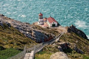
 Walking up the road from the Lighthouse parking lot, on a cliff high above the ocean we enjoy seascape vistas to the North. A small visitor shop has information and merchandise on the lighthouse. Noticing a large concrete bowl shaped area, we learn this is a man-made cistern that the lighthouse keepers built to catch water. The isolation of the lighthouse made it difficult to access water, so the keepers devised this plan for obtaining their necessary water supply. The Point Reyes Lighthouse sits on the cliff below us and we begin the 308 steps descent. A sign at the top warns “this is a strenuous hike!” Walking up the stairs is equal to walking up the stairs of a 30 story building. Even though it is a clear day, the fog horn sounds to warn ships of the dangerous waters. Pausing we take quick photos of the spectacular seascape, cliffs, and foliage. Several visitors have spotted a gray whale in the waters nearby, so we look out over the vast Pacific from a hundred feet above the ocean attempting to spot a “blow” of this whale. No luck! There are several stopping points for the visitors to rest especially as they climb the strenuous 308 steps up. At the base of the lighthouse, we walk around enjoying the scenery and magnificent views. Inside the lighthouse the Ranger explains the history of the lighthouse. On the ascent, we take our time with several stops to catch our breath, snap a photo and take in the beauty.

We then drive to the fork in the road that leads to Chimney Rock, which is a one lane road through an active dairy farm. Cows are grazing along the road and often cross the road. We laugh as we follow behind a cow taking the road to another pasture. Arriving at the parking area, an information board shows the path to Chimney Rock and the Historic Point Reyes Lifeboat Station. It is a pleasant gentle .7 mile stroll through the hillside on the cliffs above the ocean. The path initially goes along the side of the hill and then slowly ascends to the top. The hillside is treeless and grassy with low flowering shrubs. From the path and Chimney Rock the views are fabulous of high cliffs above the ocean to the north, Drakes Bay to the east and the dramatic coast to the south. . The regular sound of the lighthouse horn continues every few seconds. From the cliffs there are several rock formations just off shore with waves crashing on them.
Now back to Route 1. It is getting late and we need of gas. Our attempts to get gas proved it was not as convenient as we had hoped. Point Reyes Station is a few miles outside the Park heading north. To our relief it has a gas station. Continuing along Route 1 the road stays inland taking us toward our destination of Jenner. Hungry after a full day of hiking and traveling, plus with few towns along the road, we stop at Lucas Wharf, a large family owned restaurant overlooking Bodega Bay. A varied menu features local seafood. The choices on the senior menu fit our needs. After our seafood meal, we travel to The Jenner Inn in Jenner, CA about 20 miles along Route 1 to the North.
Arriving at the Jenner Inn, we check in and are assigned to the Avalon Room in Mystic Landing. The Jenner Inn offers 24 eclectic rooms, suites, cottages and vacation homes in a collection of 20th century homes. Our Suite is on the lowest tier of three units that stair step down the bluff above the Russian River. Taking the steps down to our unit we admire the view of the river and beaches along the other shore. Entering the suite we are quickly impressed with the attentiveness given to the room, its furnishings and warmth. The deluxe, elegant room has a queen bed, fireplace, and wet bar. The marble bath features an in-room Jacuzzi spa tub for two. The large private deck’s wonderful view of the Russian River and is a great spot for relaxing, reading and enjoy the scenery.
Relaxation, reconnecting with nature and your inner self, seem to be the spirit of the Jenner Inn and Jenner, California. To assure you get away from the “rat race” there is no TV or Internet in the room. Internet access is available in the main lodge with a guest computer and wireless access there. The room’s guest book provides excellent ideas of things to do in the area from beachcombing, to hiking, drives along the Sonoma Pacific Coast Highway and hikes to waterfalls with mediation spots along the way.

Time to relax after our full day of driving and hiking at Point Reyes. The River’s End Restaurant is highly recommended as an award winning restaurant in Jenner, we decide to check it out for after dinner drinks. Just a couple of turns down the road, we locate this rustic restaurant. The sun is setting as we walk out on the deck and look over the Russian River Gulch where it joins the Pacific Ocean. Across the river we see cars along the shore. Enjoying our drinks s we are very impressed with the menu, the setting, decor and friendly staff.

The Points of Interest sheet in the guest book at Jenner Inn recommended the drive north of Jenner for great coastal views. Up early we drive Jenner Grade known as one of the most dramatic parts of the California coast. Route 1 winds and climbs the “Grade” and at each turn the coastline is as spectacular as the view of the road as it serpentines up the mountain. The foliage is low grasses and shrubs so we can see each wind of the road on this side of the mountain. The views are awesome and much different than what we have seen along the Southern portions of Route 1 and even the shorelines in Oregon. They have their own personality as the hillsides quickly become bluffs above the Pacific. At the top of the “Grade”, we take Sonoma Pacific Coast Trail. Then walk the mile roundtrip trail taking us to the cliff edges overlooking the valley and amazing views of the Pacific. There are coves and inlets, haystack rocks and beautiful vistas. The weather is bright and sunny, with mild temperature. As we arrive at the top of the mountain, a light fog begins to roll in.
Returning to Jenner for breakfast, we are impressed with the hot breakfast of scrambled eggs with spinach, fresh fruit and warm croissant. The lodge breakfast area is cozy with other guests enjoying the hot breakfast. Before leaving the lodge, the front desk clerk gave us several complimentary wine tasting vouchers for our trip to the wine country.
The tiny town of Bodega Bay, just 68 miles north of San Francisco boasts “The NEW Links at Bodega Harbour” one of Northern California’s most impressive golf courses. The recently remodeled Robert Trent Jones, Jr. course is perched along the spectacular Pacific Coast with all 18 holes having ocean views. The course was awarded 4 stars in Golf Digest’s places to play and annually rated as Northern California’s “Top 10 Courses”.

Our experience of this Scottish style links course with its ocean views, rolling fairways, undulating greens and coastal rough is even more challenging with the fog rolling in as we tee off. Adding to the excitement of the course many times the fog is so heavy it hides not only the ocean views but the hole we are playing. The weather matches that Scottish golfers face with the wind and fog. The course has elevation changes as it winds along the bluffs above the Pacific Ocean and Bodega Bay. Additionally, some holes play over the coastal rough with blind shots to landing areas below. Periodically the fog lifts enough to really appreciate the beautiful ocean views. Despite the weather, it is a fun course calling for a variety of golf skills. Arriving at the #16 & #17 holes, we notice the foursome ahead, taking their golf bags off their cart and walking across a long boardwalk over a marsh. Quickly, we see that Hole #16 & Hole #17 are each away from the cart path across the marsh. The players must either take the clubs they need or put their golf bag on the push carts available near the tee box for #16. After playing these two holes, we return to our cart to finish #18. We enjoyed the course very much. Advice to golfers is check the weather! June Gloom, as the Californian’s refer to it, is usually foggy along the coast.
Following golf, we leave the dramatic coast behind for the next leg of our trip into Sonoma County’s Wine Country.
Suggestions for a trip:
Gas up – once you take Route 1 out of San Francisco there are very few gas stations. There is gas at Point Keyes Station about 5 miles north on Route 1 from the Bear Valley Visitor Center.
Food – be sure to either eat before you enter Point Reyes or take food with you. While there a plenty of restroom facilities, there are no food facilities at the Seashore. Again the Point Reyes Station had restaurants and grocery stores. There were a few in the towns inside the National Seashore area but very limited.
Plan your day- arrive early to have at least a full day to enjoy this beautiful area. The drive to Point Reyes Lighthouse is about 45 minutes just to get to it. Realize that any site also includes a hike to get to it, usually of about a mile round trip. We were only able to do two of the sites and wished we had more time to at least get to the beaches.
Jenner, CA – this tiny village is a good place for relaxing and seeing some of the most magnificent parts of California’s north coast. In addition to the coastal views it offers sandy beaches to the south (Sonoma Coast State Beaches), Goat Rock Beach at the mouth of the Russian River with harbor seals living there year round, Fort Ross, a historical fort built by the Russians to the north and inland are more than 50 wineries in the Russian River, Dry Creek and Alexander Valley. A good location for “sampling” the California area and being away from the crowds.


