Magnificent Views of Miles of Mountains
What’s the highest peak in the Southern Appalachians in western North Carolina? Waterrock Knob! Just outside Maggie Valley, North Carolina, Waterrock Knob boasts an elevation of 6,292 feet and is the 13th highest mountain in the Eastern United States. In prior years we have been to the highest peak of Mount Mitchell boasting an elevation of 6,684 ft. above sea level. Mount Mitchell is both the highest peak in the Appalachian Mountains and the highest peak in eastern North America. Heck, what’s 400 feet difference when seeking a hiking experience in the beautiful Southern Appalachian Mountains.
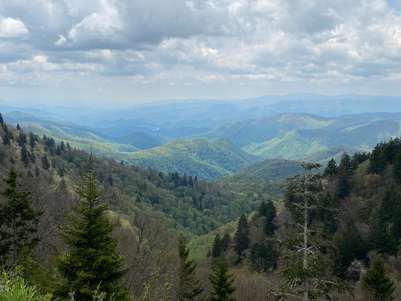
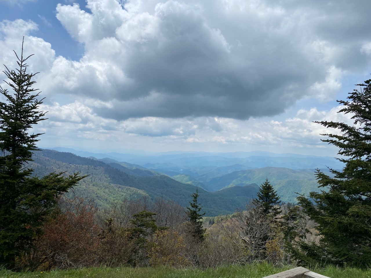
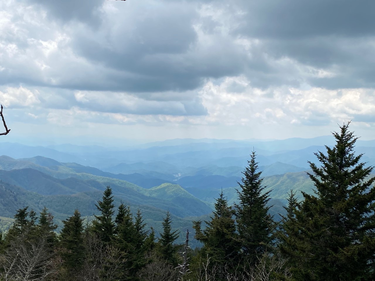
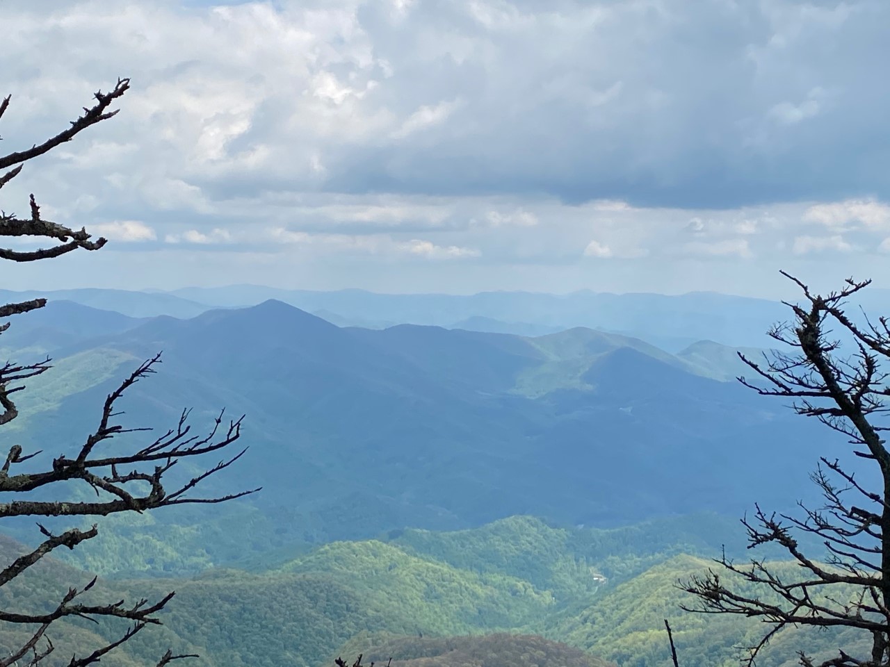
Ready for a hiking adventure to a mountain top, we pickup tasty sandwiches at the new, Maggie Valley’s Sandwich Shop. A short drive from Maggie Valley, North Carolina on US Highway 19, we turn on to the Blue Ridge Parkway, America’s longest linear park. Traveling on a Wednesday, we encounter few cars on our drive up to Waterrock Knob Visitors Center. Awesome! The views along the Blue Ridge Parkway are spectacular. Miles and miles of scenic mountain vistas are visible around each turn. Stopping at Woolyback Overlook at 5,425 elevation, we snap pictures of the amazing views. It’s important to be alert to the various overlooks along the Blue Ridge Parkway for great vantage points for seeing the magnificent mountains. Signage along the Parkway indicates upcoming viewing areas.
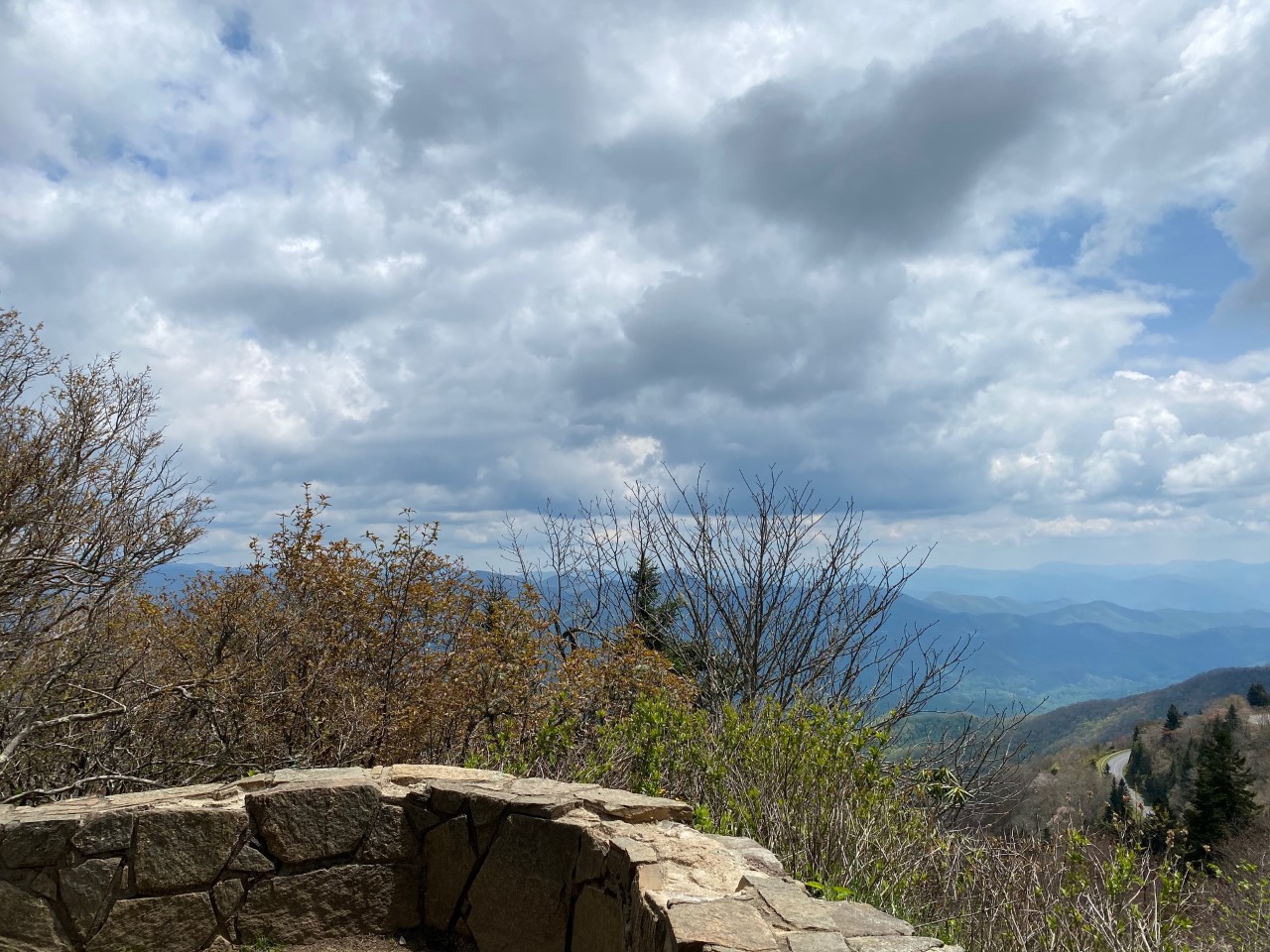
Waterrock Knob Overlook
Pay attention to signage, as if one is busy looking at the scenery, it is easy to miss the entrance to Waterrock Knob. Located at milepost 451.2 the entrance is the only place in this section of the Parkway where the road is divided. We were intrigued by the mountain scenery and missed the turn. At the Waterrock Knob Parking Lot and Visitors Center, the Waterrock Knob Overlook is at 5,820 elevation offering fantastic panoramas. Storyboards name the various mountain peaks and the distances from the Overlook. For those not able to make the hike to the top of Waterrock Knob, the Parking Lot provides excellent views. Picnic tables make a nice place to sit, enjoy a snack and take in the majestic mountains of the Southern Appalachians and the Great Smoky Mountains. The Visitors Center has great information on the Blue Ridge Parkway, exhibits, maps, and restrooms. Note: Masks are currently required to enter the Visitor Center.
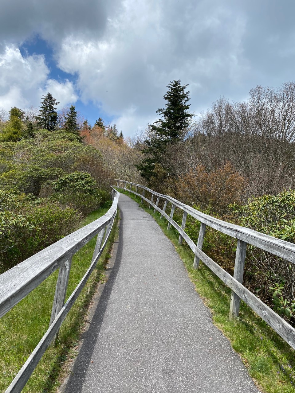
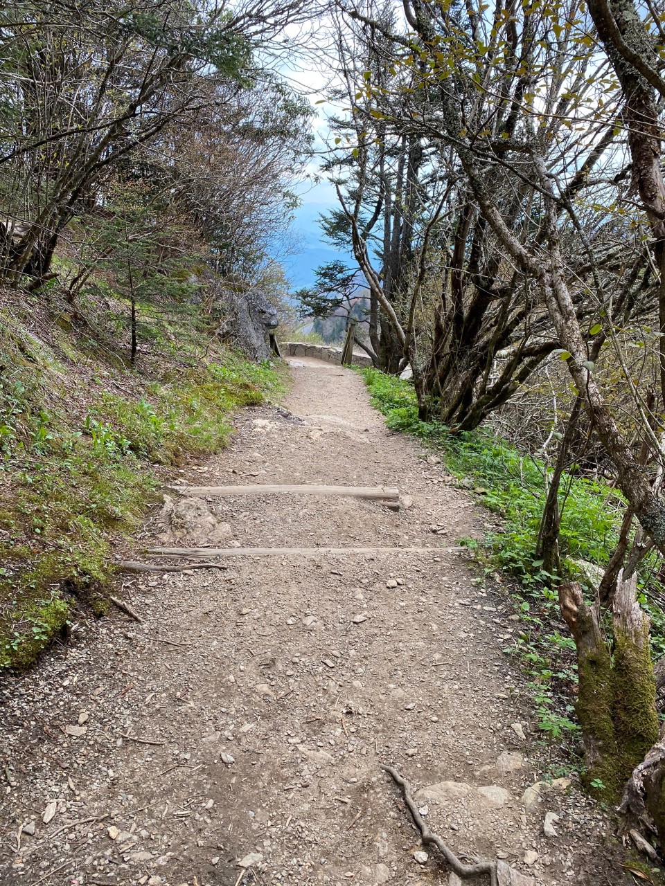
Pedestrian Trail
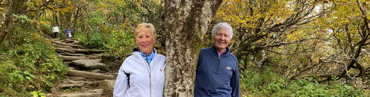
Now to hike to the top! With water and our picnic lunch we prepare to tackle the .51 mile hike that ascends 400 feet to the peak of Waterrock Knob. Signage guides us to the trail which is two sections. The first section, the Pedestrian Trail, is a paved path ascending a quarter of a mile to a walled stone terrace viewing area. A fence borders portions of the path for safety and to keep visitors off the mountain side.
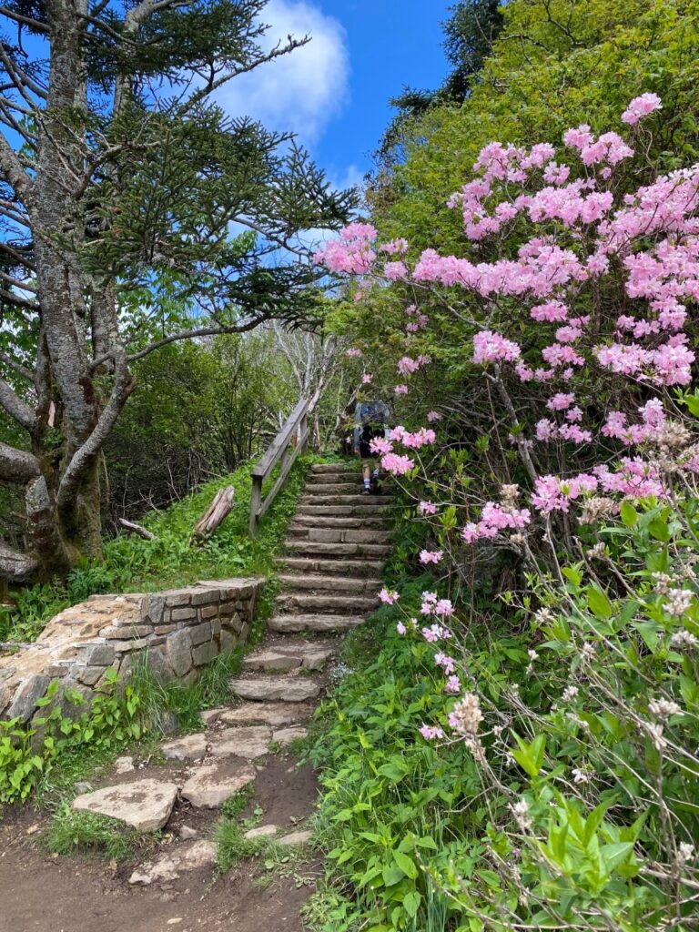
At the walled stone terrace, we take in more of the vistas and appreciate the various flowering plants along the trail.
Trail to Watterrock Knob Summit
After the paved Pedestrian Trail, the path begins to ascend up the mountain side. A rugged path of rocks and steps, that help getting around rocky areas and steep grades, ascends to the top of Waterrock Knob. Covering a half mile and climbing 400 ft. elevation means that approximately for every tenth of a mile the path climbs 80 feet.
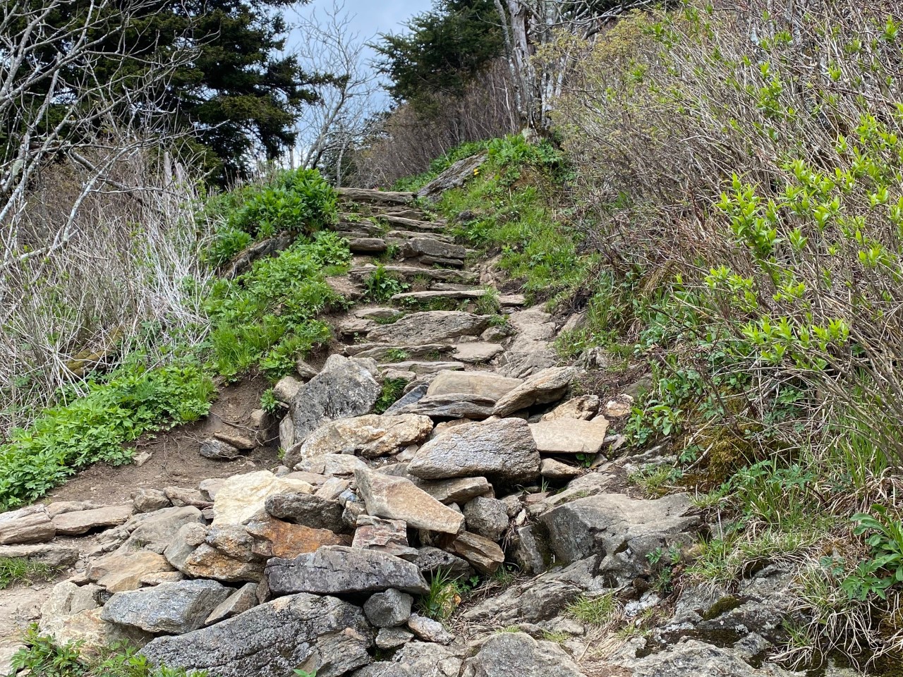
Thankfully, there a some benches along the way for a respite. Being Floridians, we make several stops to “catch our breath” with the higher altitude and energy expended as we climb to the top. Perfect times to also truly enjoy the mountain scenery, sip water, take some pictures and prepare for the next leg of the hike. At one stop looking west, we can see a huge building in the valley. It’s Harrah’s Cherokee Casino ten miles away.
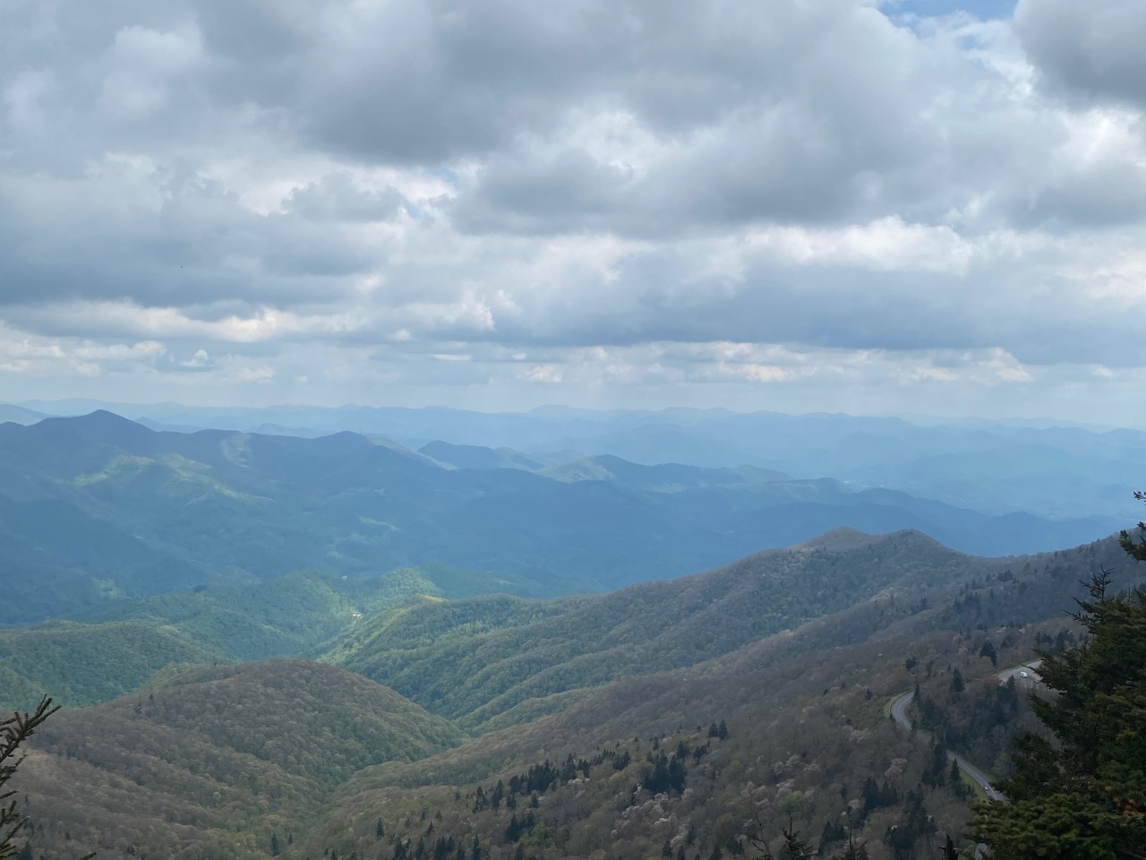
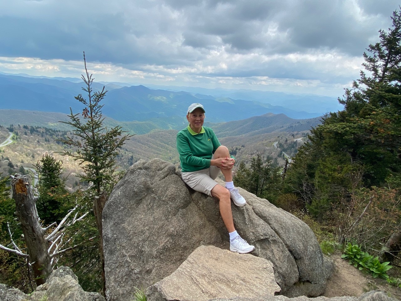
The Summit
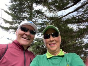
As we near the peak, the trail is a bit steeper but easy to traverse. Hurrah! We’re at the summit! Standing at top of Waterrock Knob, we have almost 360-degree views of the Smoky Mountains. AWESOME and BREATHTAKING! Walking along the top we thrill in the views in each direction of miles and miles of majestic mountains. The hike is worth!
Locating a couple of rocks, we sit and enjoy our picnic lunch on a mountain top. Peaceful, serene and scenic. Today, we are the only ones at the pinnacle. It’s our own private respite on Waterrock Knob. Allowing us to even better appreciate the Zen feeling of being one with nature.
Taking photos in each direction, attempting to capture the essence of being above the other mountain peaks.
Now to descend the trail. While we are quicker on the return hike, we still stop to enjoy the views and allow other hikers to pass. Caution is necessary as some parts of the trail are a bit steep. It’s still fun to stop and check out the vistas from different levels along the trail along with looking at the trees budding out with spring flowers and foliage. So glad we hike to the top of Waterrock Knob. It is a great adventure!
Recommendations: We highly recommend a hike to Waterrock Knob to visitors in the Maggie Valley/Waynesville area. Being less than 10 miles from Maggie Valley, it is the closest hike and Visitors Center. Later we learn there is a hike to a plane crash that can be reach from Waterrock Knob Trail. While we didn’t tackle that hike, for the more adventurous here is a link to an article on it, Hiking to a Plane Crash in the Smoky Mountains via Waterrock and Browning Knob.
Note: We hiked with the grandchildren over Memorial Weekend to find the flowers along the trail in full bloom. So pretty!
Go Prepared:
- The Blue Ridge Parkway does not have restaurants or food and in some areas is a long way from towns.
- Visitors Centers have rest rooms and some larger overlook areas have comfort stations.
- The mileage markers are not always readily visible, so be alert for specific sights you want to visit.
- Signage for overlooks have icons for restrooms and hiking trails.
- Take water, hats, sunscreen, and picnic lunches.
- Wear comfortable clothing and good walking/hiking shoes (avoid flip flops) as hiking is over varied terrain.
- Follow signage for hikes. Some have good signage for distances while others do not.
- Preplan your trip, especially for hikes know the location of the overlook or mile marker, the distance to hike with elevation changes and hiking terrain from easy to difficult.
- Speed limit on the Parkway is max. 45 mph, so driving between sights can take longer than normal on this winding road that traverses the mountain tops.
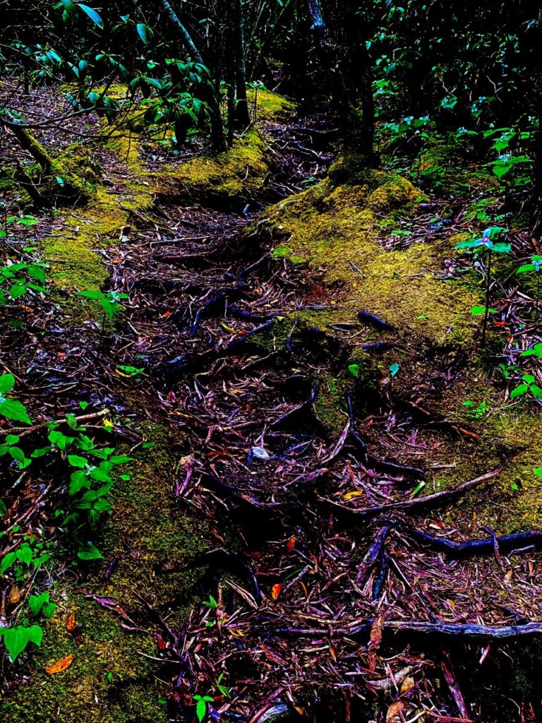
Take time to look around the path for small hidden caves or even a “River of Roots.” Have fun and enjoy the magnificent beauty of the mountains, vistas, hikes, foliage, flowers and the serenity.